Simple. Flexible. Open Source.
ODIN is a flexible Open Source Command and Control Information System.
Military decision-making process
ODIN supports the military decision-making process by helping to document the current situation and to create graphical plans and orders.
Simple User Interface
Start easily - no complicated setup procedure required
Drag and Drop to add symbols to the map - Point and Click to make changes
Touch-Screen enabled user interface
Map focused operating
MIL-STD-2525C Symbols
MGRS Grid
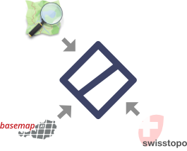
Choose public basemaps like OpenStreetMap or basemap.at or bring your own
Working in a team
Manage multiple projects
Online collaboration in realtime
Multiple different data sources
Use basemaps via X/Y/Z, WMTS or WMS
Visualize GeoJSON data imported via Drag and Drop

Further Features
Platform independent (Windows, Linux and Mac)
Import and export of individual layers as GeoJSON
Multilingual, currently available in English and German.

Open Source
Full transparency, no surprises
No vendor lock-in
No obligation to register
Get ODIN now!
Download ODIN without registration and test it!
Outlook
MIL-STD-2525D symbols
Terrain analysis
Custom symbols
APIs for the integration with own products
Join ODIN’s community!

We appreciate every contribution.
Are you a developer or a power user? Please visit ODIN at Github and support the project with your skills.

We would love to hear from you!
Questions, feedback, or just need to get in touch?
Please contact us via email office@syncpoint.io
or visit the ODIN Community on Github.
Please contact us via email office@syncpoint.io
Visit the ODIN Community on Github
Join our public Matrix Community!